Flooding in Fox Point pushed staff to find faster ways to collect damage data. Our GIS team turned a chaotic situation into a coordinated response.
Viewing entries in
Asset Management
Flooding in Fox Point pushed staff to find faster ways to collect damage data. Our GIS team turned a chaotic situation into a coordinated response.
From centralized GIS tools to real-time work order tracking, learn how the latest release of AssetAlly supports proactive public works planning and simplifies day-to-day operations.
Tracking, analyzing, and accessing essential data for a community can be a difficult, tedious task for administrators. By implementing GIS systems, questions regarding cost to manage equipment, inventory, personnel, and assets themselves can easily be answered. Learn how the Villages of Huntley and Allouez achieve their goals by using different, customized GIS solutions to manage their assets.
Municipalities are always looking for ways to improve how they share and communicate with their residents. With the emergence of ArcGIS Hub sites, R/M has helped several communities do just that. Common inquiries by residents about geographical information such as garbage collection, zoning codes, and snowplow routes can be answered through information accessed in their municipality’s Hub site.
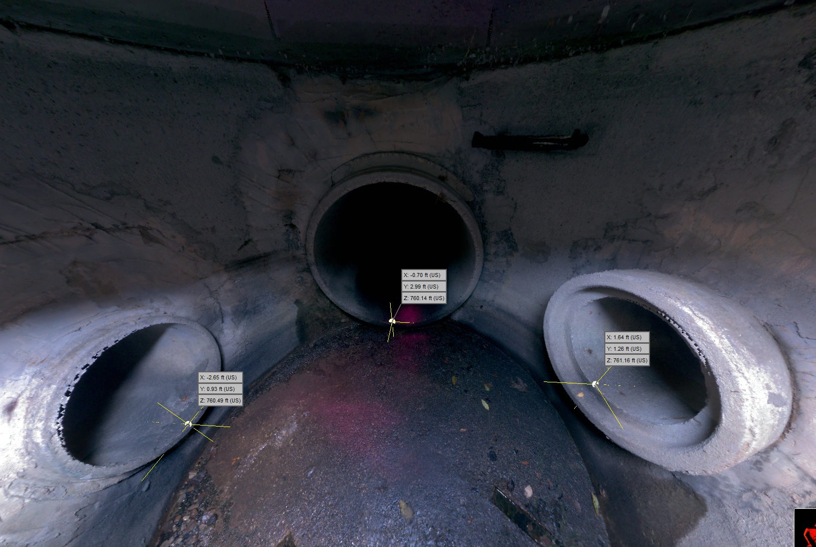
The City of Watertown recently embarked on a comprehensive capital improvement plan to rehabilitate their aging storm sewer system. Learn how they used state of the art technology to complete a smarter system inventory.
Ruekert & Mielke, Inc. launches AssetAlly, a GIS-driven solution that integrates all your community assets into a single, intuitive, digital tool that empowers your staff to be more productive with easy access to accurate infrastructure data. The best part – it works anywhere, on any device!
Conducting road ratings is only one piece of the puzzle. Having a pavement management program in place can save you time, money, and stress when it comes to evaluating and maintaining your roads.